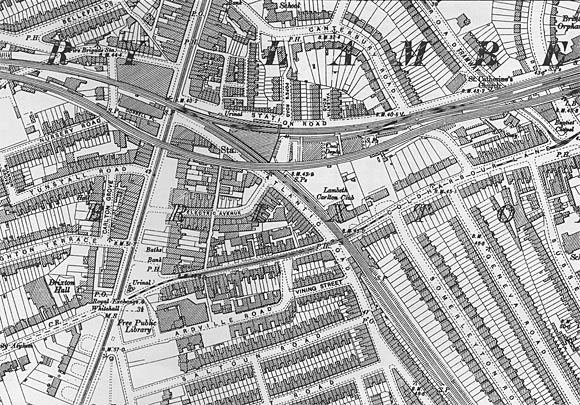
Map of Brixton area, 1894
Detail from the Ordnance Survey Map of Brixton and Herne Hill, 1894.
The area has undergone rapid urbanisation since 1870, with Brixton Lodge vanishing under new shops and Somerleyton Road being fully developed.
Note that the shops on Brixton Road are still set back a generous distance from the main road - the building line would be brought forward to its current position in 1935.
See: Brixton Road then and now
Order full size maps from Alan Godfrey Maps

« Back to history homepage Booth's Brixton map, 1898 »
|

